Thursday, April 14, 2011

It's Official: Piney River Is A Favorite

The trails following Piney River and Duskin Creek just don't seem to disappoint. We found that out yesterday, April 13th, when 24 hikers travelled to the trailhead above Spring City and by 10:30am, we had 2 groups on the trail. One was designated as the fast group, the other, I suppose would be called the 'regulars'. The fast group had to walk from the top of the road down to Newby Camp to jump on their trail and the regulars drove on down to the bridge at Duskin Creek to begin their hike.

The regulars took off on the wet trail that soon had us by Duskin Creek which we followed a good while before turning left to head up on the ridge.

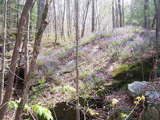
A great spot along the trail is White Pine Cascades, but before this we were already spotting sweet gaywings.
But we also spotted the amazing firepink and this unusual tree trunk with the tenacious rock attached.
As we descended the ridge on the other side of the dog leg to Spider Den, we spied yellow buckeye. Past this area, we found this hollowed area beside the bridge with the memoriam.

By now, we had spotted foam flower, spring beauty, wild geranium, dwarf-crested iris, red buckeye, and a mystery yellow bloom, Val decided must be a violet.


We passsed Hemlock Falls and by now we were following the Piney River as we continued on around the ridge, heading to Rockhouse Campsite for lunch. The fast goup had already caught up with us, passed us, and met us there where we got to see them for a few minutes. (I'll just go ahead and say we miss them!)
It took two pictures to get the group pic! (Minus Don who was taking a picture and Margaret who was down by the water.)
Taking off from Rockhouse, we climbed up a small bank, and turned right. In a short distance, we passed scenic Rockhouse Branch with beautiful flowing water.


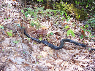
Now, we were 'smelling' the end of the trail and our paced seemed to quicken. Typical of the Cumberland Trail, we passed impressive rock boulders and the trail became rocky. We also spotted two snakes that appeared to be 8 feet long and at least a foot in diamater, but the one picture I took didn't seem to confirm that! Hmnnnn??


After this big scramble over the rocks with the water threatening some toes, we had a little more than a mile to go. It wasn't
long before we were out of the woods, and back at the cars. With a little more than 7 miles, it was a great hike on a perfect spring day.


Monday, April 11, 2011

Backpacking in the Stone Door/Savage Gulf Area

Bill Kinnaman led our group of six for a one night backpack trip to the Stone Door in the Savage Gulf Natural Area. And, as everyone now surely knows, this was the Chronicler's first backpack trip. After much preparation, planning, reading, worrying, and pure-dee-ole' excitement on my part, we arrived on Saturday morning at the Stone Door Ranger station. There, we met Deborah, a hiker from Grassy Cove who joined myself, Bill, Monty, Donald, and Joe. We had spied a worrisome cloud overhead driving in, but by the time we walked the paved path and arrived at the Laurel Gulf overlook, it had disappeared and a vivid blue sky shone on what promised to be a muggy, hot day. In this picture, Bill was pointing out that we were headed to the farthest peak in the distance....ouch!
From here, the path soon led us to the impressive Stone Door, a wide crack at the top of the escarpment with stone steps that offers passage down the bluff.


Exiting the Stone Door and down a set of wooden stairs, we began a steep descent down a rocky trail before we reached the intersection for the Connector Trail. Right before this junction, we began to see a profusion of white trilliums and lavender phlox.


To the left, we followed the ridge up and down basically to find ourselves underneath the Laurel Gulf Overlook area as we continually descended into the gorge. (At times, a bit dicey as stretches of the trail seemed to have rocks thrown haphazardly like marbles dropped along the ridge!) One sturdy swinging bridge led over a dry creekbed before the trail reached another swinging bridge that crossed a beautiful, boulder filled creek with gorgeous falls.

Bill is the man!
By now the temperature had begun to bear down, the humidity stifled, and our gait had slowed accordingly while we worked our way across the gorge. We passed Cator Cabin and paused to gaze at the isolated spot, but probably the heat factor prevented any one in the group wanting to make the trek down. We finally crossed the bridge leading to the Sawmill Camp area and Bill wisely decided to have lunch near the water and have a rest before tackling the rest of the hike. (Besides that Deborah offered a bribe if he would let us have lunch by the water!)

During the break, Bill considered the heat and decided to head toward the closer camp at Stagecoach rather than Hobbs Cabin (about a mile closer). We took off in that direction, making it approximately 1/2 mile before the heat overtook one in the group and the decision was made to head back to Sawmill for camp. (One thermometer read 96 and aother 92...either way it was HOT! Carrying packs and climbing in that kind of heat can be dangerous so it seemed a prudent call).

Back at Sawmill, we soon found a great campsite. At a leisurely pace we set up tents, collected water, and after a while enjoyed dinner. (The novice backpacker had to rely on gentlemenly Joe to heat water for her noodles. Her sterno can refused to stay lit and a lesson was learned.) After good conversation, dusk turned to dark and one by one folks retired to their tents. The next dawn found Bill up early and soon the rest roused to have morning coffee and breakfast. By 8:40am, we were off to retrace our steps which made a big difference with the heat factor. It was a steady pace on the way back, with a stop here and there to catch our breath. We were gearing up for the cliimb up the Stone Door path from the Connector Trail that we had descended the day before. We paused at the intersection again before each took to face the challenge. Bill, being the great climber he is, greeted each person as they emerged from the Stone Door, and there we paused again before heading to the Ranger Station and the parking lot. 

On a personal note, the Chronicler heartily recommends making that jump from hiker to backpacker if you are at all interested. Many in the hiking group offered the use of  equipment, gave much-needed tips, and support. Over time, equipment can be purchased to collect gear that will make the experience more enjoyable. It offers the chance to be in the great outdoors on a much more intimate level. Yes, there can be some obstacles (like seed ticks-yuck!), but easily overcome and soo worth it.

Thank-you, Bill, for a great backpack experience and thank-you, Monty and Trish for the equipment you so willingly shared. Once again, I am blown away by the generosity and kindness of the members of the Chattanooga Hiking Club.

Here are a few other pics:


Donald with his stupendous pack!

Dwarf Iris


Purple Phacelia

The novice no more!


Friday, April 8, 2011

Shake Rag and Bridal Veil Falls on the Sweet Sewanee Perimeter Trail

Our numbers swelled to 21 as we got ourselves grouped for our hike on Wednesday, the 6th. Then, it was a bit of a challenge (with poor Pete driving the lead car) to find the road that led to our parking spot for the Shake Rag trailhead. But the roads thru the University of the South provided a scenic drive, so it was all good. Wow! We were rewarded with a spectacular view of the valley between this section on the Cumberland plateau and Lookout in the distance. 


 Soon, the fast group took off and the remaining members followed on an easy descent. Similar to so many of the trails on the Cumberland, we were confronted with boulders almost immediately and even had to maneuver down thru a dicey spot. We managed the climb down this rocky area, descended a bit further, and the huge wall of boulders were then in our vision off to the right as we wound along the trail.
 The sunlit-dappled forest floor was a wildflower lover's dream and we oohed and aahed over each one we spotted: vast area's were carpeted with green mayapple 's about to burst forth with blooms, blue cohash grew in lovely bunches, dutchmen's britches sprouted delicate blossoms, trillium's dotted here and there along the path, shy, elusive jack-in-the-pulpits, sweet wood anenome's, bluish/pinkish phlox clambered for attention,  a lone purple wakerobin was adored, and finally, toward the end of the mile we enjoyed white trillium's.


To the Chronicler's shame, her camera skills failed her and some of the picture's did not turn out well. :-( 


The fast group followed the trail out and reported there was a steep climb out, but the others turned around about a mile in and retraced their steps back to the cars. This provided more delight in the beauty to be seen beyond the beautiful flowers.


The woods are about to green up!


Back at the top, we paused to enjoy the view again while we regrouped.

Che gave us the background on the trail name- Shake Rag. I believe she said it involved women shaking a rag to let the 'shiners know them thar revenuer's were out and about.


Then we were off in search of the parking spot for Bridal Veil Falls (which is apparently harder than it sounds!) At the elusive parking spot near Cheston Lake, we delved back in the woods and made short work of the trek down to Bridal Veils. There weren't as many wildflowers, but the Falls provided a great spot for lunch.

The water emerged from underneath two rock formations about a third of the way from the spine of the ridge. It then fell down into a deep, mysterious sinkhole. Where does it go from there? I don't know the answer and that makes me want to go back and find out. This is why mountains are so important. They contain a life force we don't always understand and shouldn't mess with! Okay..off my soapbox (for now).


water source


The Chronicler had to search out where the water came from.


Lovely moss at the mouth of the 2nd water source

Limbs crossed down in the sinkhole


We paused for a while at the falls before heading out again. Back up the trail, we came to an intersection and chose to go back a different way. Okay..I'll be honest. I don't know how we went from here. We meandered a bit on a lovely trail with views on occasion from the bluff. However, one bunch took off across a creek and bushwhacked their way to atop a ridge looking for a blaze. At one spot, the remaining group paused trying to locate exactly where we were.


Scenes along the way.

This will be canopied by foliage soon


 We finally emerged from the woods to find Lake Cheston and the trail by the lake that took us to our cars. Ray estimated about 5.25 miles. A lot of the folks stopped by Sonic by Interstate 24 while others headed back to Scenic City. The Trail Chronicler enjoyed her first ride in her Subaru to the trail with her hiking buddies in the car (and Ray-Man was the able navigator!). The new Subaru now has trail dust and shall henceforth be known as Ruby! See ya next week, trail friends!