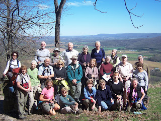
Our numbers swelled to 21 as we got ourselves grouped for our hike on Wednesday, the 6th. Then, it was a bit of a challenge (with poor Pete driving the lead car) to find the road that led to our parking spot for the Shake Rag trailhead. But the roads thru the University of the South provided a scenic drive, so it was all good. Wow! We were rewarded with a spectacular view of the valley between this section on the Cumberland plateau and Lookout in the distance.
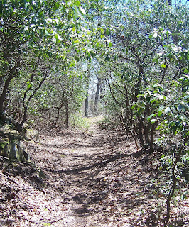
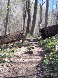
Soon, the fast group took off and the remaining members followed on an easy descent. Similar to so many of the trails on the Cumberland, we were confronted with boulders almost immediately and even had to maneuver down thru a dicey spot. We managed the climb down this rocky area, descended a bit further, and the huge wall of boulders were then in our vision off to the right as we wound along the trail.
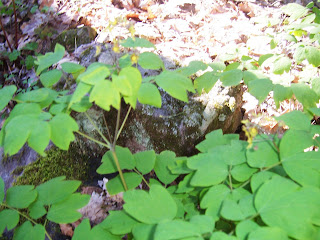
The sunlit-dappled forest floor was a wildflower lover's dream and we oohed and aahed over each one we spotted: vast area's were carpeted with green mayapple 's about to burst forth with blooms, blue cohash grew in lovely bunches, dutchmen's britches sprouted delicate blossoms, trillium's dotted here and there along the path, shy, elusive jack-in-the-pulpits, sweet wood anenome's, bluish/pinkish phlox clambered for attention, a lone purple wakerobin was adored, and finally, toward the end of the mile we enjoyed white trillium's.
To the Chronicler's shame, her camera skills failed her and some of the picture's did not turn out well. :-(
The fast group followed the trail out and reported there was a steep climb out, but the others turned around about a mile in and retraced their steps back to the cars. This provided more delight in the beauty to be seen beyond the beautiful flowers.
The woods are about to green up!
Back at the top, we paused to enjoy the view again while we regrouped.
Che gave us the background on the trail name- Shake Rag. I believe she said it involved women shaking a rag to let the 'shiners know them thar revenuer's were out and about.
Then we were off in search of the parking spot for Bridal Veil Falls (which is apparently harder than it sounds!) At the elusive parking spot near Cheston Lake, we delved back in the woods and made short work of the trek down to Bridal Veils. There weren't as many wildflowers, but the Falls provided a great spot for lunch.
The water emerged from underneath two rock formations about a third of the way from the spine of the ridge. It then fell down into a deep, mysterious sinkhole. Where does it go from there? I don't know the answer and that makes me want to go back and find out. This is why mountains are so important. They contain a life force we don't always understand and shouldn't mess with! Okay..off my soapbox (for now).
 |
| water source |
The Chronicler had to search out where the water came from.
 |
| Lovely moss at the mouth of the 2nd water source |
 |
| Limbs crossed down in the sinkhole |
We paused for a while at the falls before heading out again. Back up the trail, we came to an intersection and chose to go back a different way. Okay..I'll be honest. I don't know how we went from here. We meandered a bit on a lovely trail with views on occasion from the bluff. However, one bunch took off across a creek and bushwhacked their way to atop a ridge looking for a blaze. At one spot, the remaining group paused trying to locate exactly where we were.
Scenes along the way.
 |
| This will be canopied by foliage soon |
We finally emerged from the woods to find Lake Cheston and the trail by the lake that took us to our cars. Ray estimated about 5.25 miles. A lot of the folks stopped by Sonic by Interstate 24 while others headed back to Scenic City. The Trail Chronicler enjoyed her first ride in her Subaru to the trail with her hiking buddies in the car (and Ray-Man was the able navigator!). The new Subaru now has trail dust and shall henceforth be known as Ruby! See ya next week, trail friends!


Reggie,
ReplyDeleteAnother great description of our hiking adventure on Wednesday. As always, I enjoyed reading your blog.
Arlene