Friday, March 25, 2011

Hiking the Walls of Jericho With The Fast Or The Slow

Loosey-goosey was the order of the day on Wednesday, March 23rd, with the hiking group as we divided up in groups to hike in to the Walls of Jericho. The usual fast group, plus a few others, (Wayne, Richard, Deb, Stormy, Larry, plus, Pam, Lou, Susan, and Monty) took off ahead to get in and out asap while the 'slow' group: Che, Bill, Arlene, Patti, J.D., Sue, Diane, Jenny, Trish, Val, Gwen, Reggie and Kathy were led by John. This year we parked a little further up the road and took off from the Tennessee side of the ridge. A short walk through the woods brought us to the overlook with a plaque pointing out the ridges beyond the gorge.

From this point, we turned left to wind along the edge of the bluff with the cold wind buffetting against us for a short distance before the trail began to descend. Our boots had to trudge through some muddy spots, but as we dropped further it seemed to dry out a bit and soon we spotted what we came for: wildflowers!


We had descended 1.2 miles down the ridge when we came to this spot. As enjoyable as it was, with folks stopping  along to identify flowers, occasionally someone would mutter..'what goes down, must come up..'.


The trail wound further along the ridge, almost always with a downward grade. Those spots where our boots went up, John made sure to point out so that we could appreciate it all the more on the way out! Finally, we arrived near the bottom of the gorge and found ourselves by the creek. The woods reflected this nourishment with an influx of green in our surroundings.
We had already delighted in the virginia bluebells we spotted which were gorgeous, but then we made a turn to find ourselves in a dream world where bluebells flourished with dutchmen's britches interspersed liberally in the mix.


As we passed through, there were ooh's and aah's aplenty! Across the creek, the woods were carpeted with bluebells...the stuff of dreams (the Chronicler actually had a dream about an area like this once...and here I found it!).


On an easy path, we travelled by the creek and soon passed the sign that marks the Walls of Jericho trail from the shorter, but more steeper trail that was used last year. Then, in no time we were at the log crossing with the nifty board rail.

The trail goes straight here just a short distance and then begins a small climb. Here we ran into several of our fast group heading out already.


Unfortunately, I failed to picture Deb, Pam, Monty, or Larry, but I did get our special tree! We did find out that Stormy and Larry were injured on the barbed wire fencing beside the creek we rock-hopped. Caution!


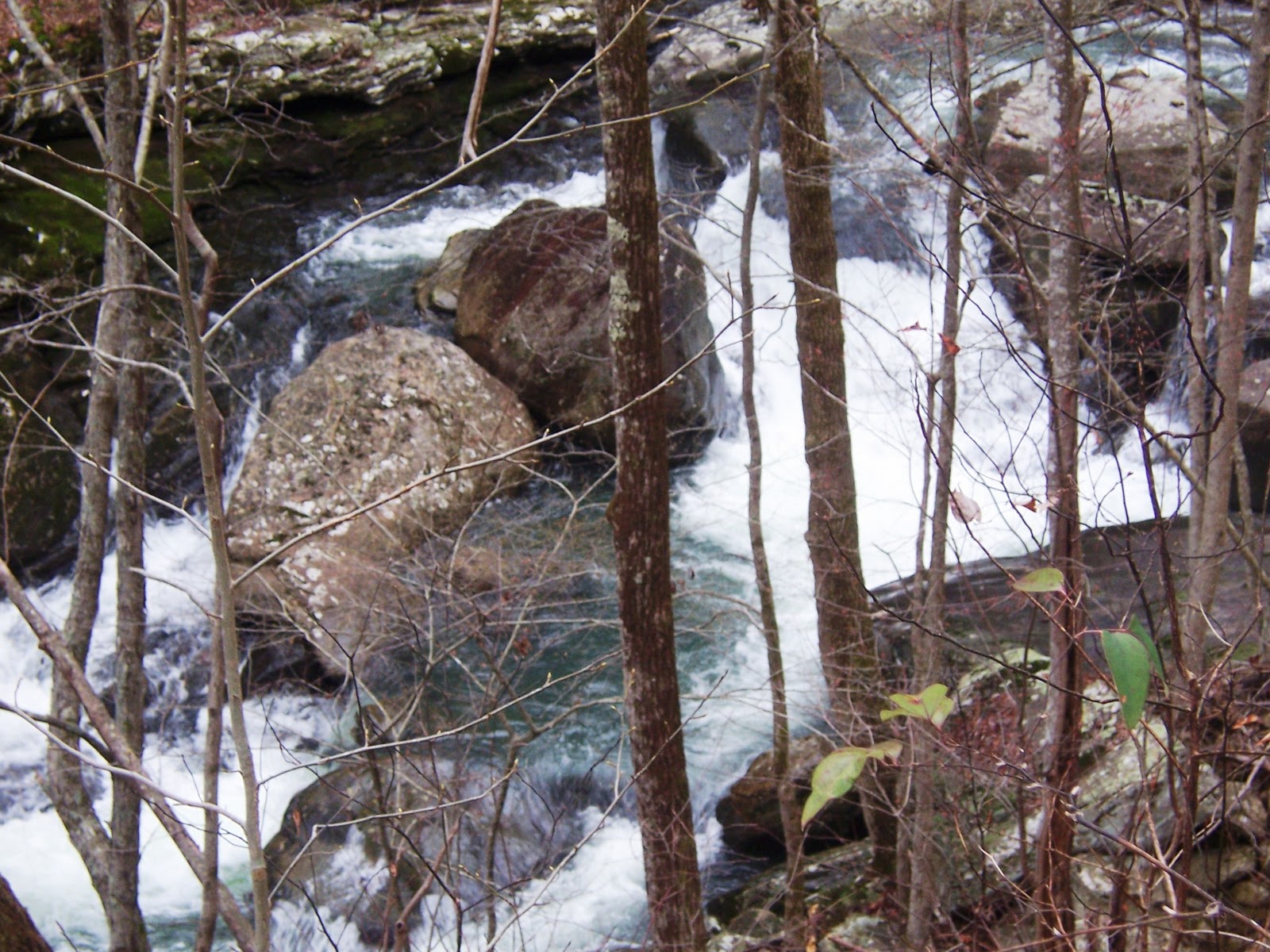
Beyond this point, we came to the creek crossing where the log was too precarious so we rock hopped and made it to the other side. J.D. elected to stop at the picturesque old cemetery to have her lunch in quiet as the rest of the group began to climb the ridge. We missed the gorgeous white blooms from last year, but their greenery still dotted the gorge along the creek.


The trail finally angled back to the creek we were following and it was the individual hiker's decision how to get across. Some had plastic, others had water shoes, and still others just slogged in and got across to the bank where we climbed over to the limestone rock area by the falls. Here we settled down for lunch. After a quick bite, the Chronicler (with instructions from Bill) found a foothold and got up the rocky ledge to the waterfalls beyond. She was followed by Diane who truly enjoyed her first look at this unique spot, and also John and Susan.


We reluctantly left our lunch spot in this amazing limestone gorge, got back across the creek, and began our ascent around the ridge. Back across the log bridge, we all garnered our strength for that climb out. Whether it was a personal mantra as Trish does or just one lead foot in front of the other, we all made it out of the gorge. The last few got caught in the downpour as it finally hit! Sue thanked good girl scouts, J.D. and Jenny for their assistance, but she, too, got back to the trailhead. There was some discussion on whether this was the better of the two ascents, but either way, there is a difficult climb to overcome.

Here are a few more pic's:

Trillums dotted this huge rock


Redbud colored the ridge on our descent


Approximately 8.8 miles..and even with the climb..it's a special hike. An extraordinary place with echoes of the past seemingly held hostage by the Walls of Jericho.

Tuesday, March 22, 2011

Laurel-Snow on the Cumberland Trail; Divide and Conquer

27 hearty souls eventually got together at the trailhead above the city of Dayton for the Laurel-Snow hike on a chilly morning last Wednesday, March 16th. We quickly got our boots on and not so quickly got assembled for our group picture! Included were 2 of Che's grandchildren, Tristan and Raven, and I have to say, these two made the hike so much more enjoyable. Richlands Creek flowed freely and with the recent rains created a frothy display in lots of places as we made our way alongside its' banks.


This picture was taken within yards of the trailhead. All along this part of the path, there are remnants of the coal industry from the turn of the century.


There are numerous places along the path that beg for a picture to be taken! In less than a mile, we were at the sharp right turn that took us up the escarpment at an easy climb, always within sight and sound of the water.  At the turn, I found my first spring flower: hepatica.


We meandered at an easy pace until the whole group crossed the bridge and gathered to finally 'place their bet', meaning you had to decide if you were going with the group to Laurel Falls or the group attempting Snow Falls. After hemming and hawing, the Snow Falls group took off with Che and her grandchildren swelling our number to 17. As we started out again by the water, we began to spot more and more wildflowers. This area was particularly rich with trout lily sprouting up, toothwort, hepatica, foam flower, violets and bloodroot. The rocky path we followed soon turned away from the water and we delved into the woods. At times we had to climb over or around tree's that had fallen with huge boulders up on the top of the mountain, standing like stone Indians watching our higgily-piggily line of hikers strung out on the face of the mountain. Then, it was another sharp turn up where we at a steeoper grade and our steady march slowed. We passed the 'cave' rock  right before we passed thru the huge 'stone doors'.


We passed through the doors and it dumped us out at an intersection where we turned left. After a short walk, we found a gorgeous overlook where we could see Laurel Falls in the distance and waved to our unseen friends on the other side. Another spat of hiking and we arrived at Buzzards Point (or was it Raven Point?). Here we settled down on the huge rocky promentory and enjoyed our lunch. There was a bite to the wind, but it was still very enjoyable!

After lunch, Deb, Raven, Tristan, and Reggie, followed Wayne down a ravine between the largest rocks at the lunch  spot to get a look at the drawings on the rocks down under. There was grafitti drawn, as well, which took away from the site, but there was definitely a drawing to view. Wayne has been told they are Indian and very old. 

Finally, we got the group together and took off again in search of a crossing to Snow Falls. We crossed under power lines and a stubbly sage grass field and into the woods again. After some hiking, we wound back and found ourselves at the creek crossing that proved too much for most of the group. But Tristan, Raven, Richard, and Deb jumped in and crossed over to find their way to the falls. The others high-tailed it back up to loop back to the 'stone door' and back down the same trail we had hiked in on. Che surmised that we hiked approximately 10 miles. 

The following pictures show much of our hike.  


Monday, March 14, 2011

Laurel Falls and What Lies Beyond

Ater a stop in Cleveland to pick-up Kathy S. we had eight folks in 2 vehicles for a hike to Laurel Falls and beyond to the firetower. (Wayne C., the leader, Che C., Bill K., John R., Stormy M., Arlene S., Kathy S., and Reggie J.) Yes, it was early, but we chatted and the miles flew by so that before you knew it, we were leaving Maryville and headed toward Townsend. Here a slight problem developed: rain! All four ladies in unison cried: Waayynnee! Most did not have rain gear, but after a call to Wayne in his car, we were all assured- not. :-)  In Townsend, we began to see snowy patches on the ground and by the time we turned into Wears Valley, the rain subsided. However, as we began to climb, it became evident we were probably going to be hiking in the snow.

This was confirmed as we crossed the bridge at Little River and drove to the trailhead. It didn't take long to get our gear on and jump on the paved trail. Our boots crunched along the path in about an inch of powdery snow in an easy, meandering climb. The trail follows around the mountain so that the pathway drops off the side on to your left. With the stark winter foliage covered in white, we could easily see Laurel Falls Creek frothing below as it flowed away from the Falls where we were headed.


We made quick work of the 1.3 miles to Laurel Falls and were rewarded with ferocious, untamed water surging over the falls which rises 75 feet to fall underneath the bridge where we stood and admired Mother Nature.

Standing on the bridge, you are able to watch the flow of water over the boulders and on down the mountain. 

Just beyond the bridge, the rocky path turns left to begin the climb up to Cove Mountain Junction. As we traveled up the path away from the falls, the snow deepened (eventually, about 4 inches) as we climbed in elevation. Soon, we were enjoying snow-blanketed woods that were home to gigantic trees. Wayne pointed out the ragged, red bark of Carolina Silverbells that were bigger than I had ever seen. At times, the trail led us under a arbor of snow covered trees.


Bill jumped ahead and for a good distance he troughed through pristine snow.


When we arrived at the trail junction, he offered someone else the chance to experience this pleasure!

At this point, we were only .9 miles from the firetower, but what we encountered as we climbed was an experience particularly hard to describe.


The woods became misted, creating a dream-like aura: Limbs flocked with snow, vertical lines of  bark, dark lines against the pure white reaching up and up.

As a group, we grew quiet as we climbed; awed by this gift of nature we were witness to. We pointed out scenes in near whispers:. "Look at this," one would say as we all turned to gaze at a laden pine shaped like a perfect christmas tree. "Oh, look," another would voice, pointing out a growth of rhododendron mounded with white. Many had never witnessed hoar-frost and Wayne delighted in pointing it out. The atmosphere became etheral, the mountain sacred and we were there to worship, sharing joyous moments amongst friends. We knew each of us was thankful for the experience and each conscous that these moments could never again be recreated. We delighted in each bend of the trail and arrived at the firetower on a high note! The next few pictures offer only a glimpse of what we saw for there is no way a camera can convey the true beauty.


Too soon, we were headed back. Stormy and Kathy jumped ahead and met us at the cars. As we descended the 1,750 feet we had climbed, blue sky was spotted overhead and sun dappled the mountain peaks off in the distance. Going down, of course, was much faster. Wayne finally determined that the famous 'tree with the hole'  had fallen over.


 When we reached Laurel Falls it was being enjoyed by lots of folks. The views of the mountains in the distance were beautiful!


All in all we accomplished 8.2 miles, but more than the miles of hiking, it was the experience of a lifetime with dear friends.