Monday, November 15, 2010

Flipper Bend Trail Serves As a Substitute

Wednesday, November 3rd, we were headed to Tommy's Point, but the imminent rain changed our plans. After much ado about meeting, with some here and some there, we finally got together at the trailhead on Signal Mountain. Fourteen of us headed out of the parking lot under gray skies. The trail immediately dropped us into the woods which had already shed enough leaves to create a soft footfall. The rain in the preceding days created a bit of a muddy path in areas.

 It wasn't long til we came out of the woods onto a paved road that continued on behind a gated subdivision to our left called  Boston Branch. We crossed the road and disappeared in to the woods (after after making sure Bob was in sight). In the past, Che had said she sometimes had trouble finding the trail, but she did fine on this day as we came to an old roadbed and followed it down until we were on another stretch of woods where we took off to the right. About a mile further, we trekked by a clearing with power line towers that provided a bit more of a view. Farther, on we took a right turn and this brought us to an overlook where we could see Soddy-Daisy and the Sequoyah towers' in the distance.


Stormy perched on the point over North Chickamauga Gorge down below and we all settled down for lunch. We were chit-chatting and having a good time of relaxation  until a wave of dark clouds overtook the gray sky and we all jumped up to don our rain gear and head out. Some of group barely had enough time to eat a few bites! Arlene made sure to get her apple in at the last minute, though!


The trip back was under a soft rain that fell in bits and bursts, but never hard. The trail had us climbing more on the way back until we joined the point where we had turned right on the way in, then it was the easy trail that we had on the way in. We passed an interesting stacked rock formation where we stopped for a group picture. After this, the rain settled in and our feet picked up the pace to get back to the cars!  A good 8 mile (maybe a little more?) hike, proving once again that a hike in the woods is a good thing on any day. Rain or  no rain!

Tuesday, November 2, 2010

Big South Fork and Pickett State Park (and Thingy's and Gray Areas!)

Tuesday morning on the 26th, 14 adventurers set off with our vehicles packed full of food and gear (in that order!) from the Sequoyah Road exit and headed up Highway 27 for the historic town of Rugby. We enjoyed lunch there and walked around the small town a bit before heading on up Hwy 52 toward Cloditz Cove Natural Area.


We found the pull-off for the trailhead and took off on our first hike of the trip. It is an easy 1.5 mile loop that takes you behind Northrup Falls. The walk to the bluff overlooking the falls is a short distance so we turned left and headed down into the gorge for a close-up view. Soon, we were rock-hopping and oohing and aahing over large rock formations. Kathy took it slow and easy and even she made it down to stand underneath the huge ledge by the falls. It was a bit of a scramble down the rocks to go behind the falls so Kathy, Rusty, and Karen turned to retrace the trail back. The others enjoyed the misty view behind the falls and clambered over the rocks to climb out of the gorge. Once on top, it was a nice pine straw path back to the trailhead.


By the time we reached the cabins at Pickett State, it was obvious we were in for some bad weather so we unpacked quickly and set to work on getting our evening meal ready. Rusty served his famous baked beans while Gary and Judy cooked hamburgers and hotdogs, and Linda provided a great salad. We then sat around and tried to figure out ‘the gray areas’ (which we didn’t), Rusty kept an eye on his ‘thingy’, and the Chronicler tried to no avail to get up a game of charades.

Wednesday morning, Trish and Val provided a wonderful breakfast of omelets prepared in an intriguing manner. She and Val had all sorts of ingredients: scallions, peppers, mushrooms, olives, etc. , which were chosen as individuals desired, then scooped into plastic bags of raw eggs and placed into boiling water. The results were delicious omelets!

Karen stayed at the cabin so that left 13 of us headed for the trailhead; however, a trucker had a mishap on the curvy road headed the opposite direction. After stopping to investigate for a bit, we turned around to backtrack to Big South Forks’ Visitor Center. Here we got information to reach the John Litton/Slaven Farm Trail by way of Bandy Creek Campground and off we went. Finally, we were off on our big day of hiking and in no time at all waved bye-bye to Richard who we wouldn't see again until after most of the mornings' hike. The day was fresh and just a bit cool as we started, the woods wet from the rain the night before. Just a short distance on the trail, we came to a wooden ladder that we had to descend. We climbed down and found another, longer wooden ladder that led down even further. Now, we were deep in the woods, following a trail that led in, around, and under great rock ledges and boulders placed here and there by the indiscriminate hand of God. We came to the sign pointing the way to the old Litton/Slaven farmstead off to the left, about 2 miles away which we followed and emerged from the woods to an idyllic spot tucked away in the mountains.

We snooped around the old house, explored the small pond nearby, and gazed at the impressive barn and split-rail fence and imagined days gone by when we, ourselves, might have lived in such a place. The big, blue sky made it even more beautiful and even a bit sad as we left our dreams beside the trail and said good-bye. We climbed out of the small cove and back up to a rim of sorts where not too far away Richard, as planed before, had already gotten back to the parking area and brought back a car. Rusty, Kathy, and Linda got their 5 miles done and headed back for lunch and a relaxing afternoon.

The 10 remaining walked on and got picked up and drove to Leatherford Trailhead where we took off on on part of the Grand Gap Loop to take in the 1.5 mile hike to Angel Falls Overlook. This is also part of the John Muir Trail. We came to a set of boulders jutting out over the rim and the view was, indeed, gorgeous. The sky opened over the deep gorge like scroll rolled open to reveal treasure. We saw the river snaking through the valley, and the forest on every side inviting souls to venture in. Five in the group decided to head on to the cabins, getting in a good 7 miles.

Richard, Gary, Arlene, Gail, and the Chronicler wanted to get a few more miles in and continued on down the trail. In no time, we came around a bend and discovered THIS was actually the Angel Falls Overlook! Somehow, it managed to be even more impressive than the previous overlook. We had to jump from one huge boulder to another (or climb down and up) to get out and take in the fantastic scene. Here, we saw the Big South River down below and caught sight of some rapids. The gorge actually opened up like a t with the one leg being the previous overlook we had seen. The trail brought you out to this juncture, followed on around the mountain and which we did for a couple more miles. We passed a deep cave structure, perfect for a bear sleep-in! We had allowed ourselves a time limit and reaching it, we started back. Richard came up with a great time-passer, and we began name games. Four of us got in 10 miles while Richard, due to his extra trip earlier, got in about 12 miles.

That night, thanks to Karen, we enjoyed baked ziti, Caesar salad prepared by Pat, plus applesauce cake provided by Karen. After dinner, Bob built the perfect fire and we sat around its' cozy warmth and enjoyed precious time underneath a blanket of stars. Rusty kept us rapt as he wove the story of ‘Sop-Dall’. By one's and two’s they left until there were only five and, then Bob doused the fire to end the night.

Arlene, with Gail’s help, cooked sausage, bacon, and eggs, while Richard provided a delicious fruit bowl for breakfast. We packed, said farewell to the cabins, and drove to the swinging bridge near the Visitor’s Center. It was another, absolutely, gorgeous day as we walked cross the bridge and enjoyed the scenic spot over the water. A twenty minute drive got us to the O&W Trailhead (Oneida & Western Railroad Trestle). This is part of the railroad which ran between Oneida and Jamestown. The trail is right by the road and begins underneath a bridge over Big South River. Taking off to the left, we followed beside the river, with a small elevation gain. We came to a deck with stairs that carried you over a rock formation, however, most of us explored the passageway between the huge boulders and found ourselves at a scenic spot beside the river. Jumping back to follow the trail, it was an easy hike with many places that invited picture taking. We met Richard who was turning back to get a jump on his return trip home. (We found out he walked back to the parking lot with Kathy.) We emerged at the end to find the very interesting trestle bridge over the river, and we enjoyed a nice break on the bridge. (Research shows this is a ‘whipple truss’ design from the mid-1800’s, no longer in use today.) We retraced our steps for a 4.7 mile hike and, thus, ended our fall trip.

Gail and Arlene rushed back to Chattanooga, but the rest just couldn’t say goodbye so we drove to The Cookie Jar in Dunlap and had a last meal! Thank-you, again, to Val and Trish for a well-planned trip and to everyone who went, not just for the kindnesses shown to each other, but for being so accommodating to one another during the trip.

Thursday, October 21, 2010

Soddy Gorge on October 20th...9 Miles or Bust!

The morning was a bit overcast as 24 of us met at Jones Gap Rd. off Hwy #111 to figure out the shuttle to the trailhead. Don Deakins tackled the job and eventually we followed like lemmings to the end spot off the highway, left a few vehicles, then headed over to Hot Water Road where the trailhead began. By now, the clouds were gone and the blue sky overhead boded well for our day. Soon, a long line of bobbing heads undulated along the trail. The rain from the night left the ground dampened, but also the woods smelled fresh as we weaved along the ridge that took us up and then down a nice set of rocky steps and on around the mountainside. As a foretaste of what we would see over and over again, we came out at a huge rock outcropping, so typical along the Cumberland, and continued on.

The woods didn't shout their beauty, the colors did all the bragging..muted oranges, shades of green, sweet yellows, and bursts of crimson adorned our views all the way. By the time we finally got to Deep Creek, we were lulled into a sense of ease. But, here we soon braced for a tricky climb down the slippery rocks. As usual, the guys in our group jumped in to make sure the ladies made it down safely. (Don't we have some nice guys in our group?!) We took our time and then we were on the other side for a huff and puff climb up out of the gorge. Our reward was a another spectacular rock outcropping that extended all along the ridge with beautifully formed ledges that begged for exploration. We passed the coal shaft where the posts were stiff visible and the darkness yawned.

After another careful climb down into Soddy Gorge, there was another scramble up to the top of the ridge with more gorgeous outcroppings. Along the way, the Chronicler spied mysterious dark openings in the rocks, knotty growths attached to trees like nubby appendages, and intricate webs designed by spiders seeking prey...and all with wonderful hiking buddies!

Lunchtime was delayed a bit when it became obvious we weren't going to get to the assigned spot until well after folks needed to eat, so a few of us just stopped at an inviting spot to eat while the others who were already ahead continued on and ate lunch where they were. Alas, we were never rejoined until the end of the trail. But what a fantastic day! 9 moderate to strenuous miles, but a great hiking day!

Friday, September 17, 2010

Pot Point Trail Maintenance


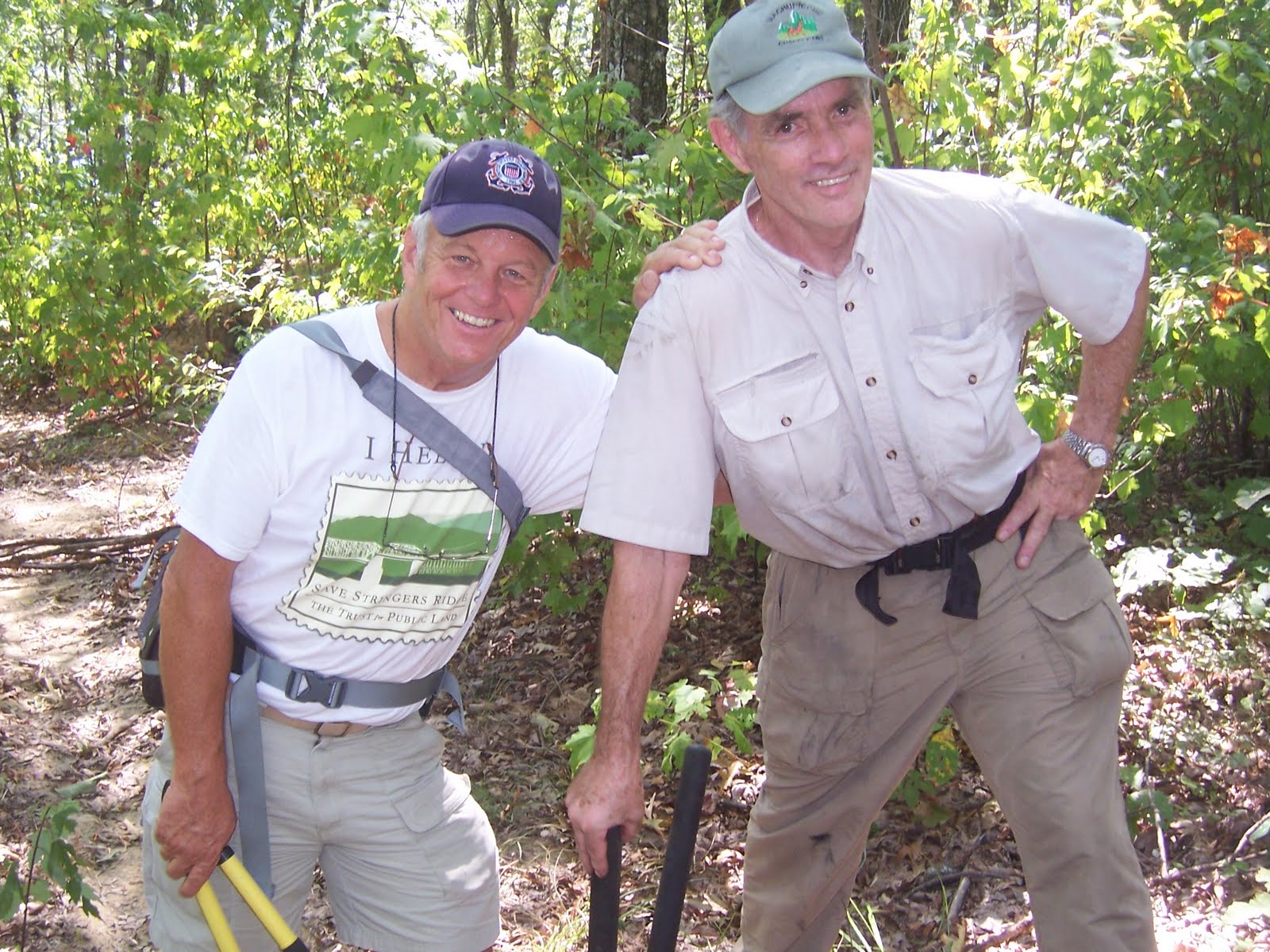
It took almost 50 minutes to get the intrepid Wednesday group from the Bi-lo at Signal Mtn. Road to the parking area at Prentice Cooper State Park where we geared up for our day of maintenance. Donald Box wouldn't let the ladies slide by with a little pair of snippers! He came prepared to hand out loppers...thanks, Donald, I guess. :-(  We divided up with 7 following John-the-Man Rowland and 8 with Mama-Che and Donald. We all walked north together and then our group broke away and continued for approximately 2.5 miles.Then the groups were using their swing blades, loppers, and snippers with a plan to meet about the middle.

In John's group, he, Gary, and Monty shared the use of the swing blade while J.D. used the saw, and Trish, Patti, and I alternated the use of loppers and snippers. Our goal was to follow Donald's request to clear a 4 x 7 foot area on the path. By the time the two groups met for lunch, I heard a few groans and sighs, but it was all good.


I suspect those of us who aren't normally on the maintenance crews will certainly appreciate them much  more!

Beautiful Bald River Falls With Betty!

If Betty Petty is leading the hike, you can't go wrong. With that in mind (plus the fact that it was the anniversary of 9/11 and it's too sad to be at home and think about it), the Chronicler got up on a slightly wet Saturday morning and drove to Ooltewah where 10 of us divied up in cars and headed North. Steve very kindly led us to where his work van was parked and we all loaded up and continued on to Tellico Plains.

By the time we arrived at the lot by the Falls, the rain had arrived so we quickly got on the trail which began right beyond the falls, up a path that led across a wooden bridge. From up behind the Falls, we fell into an easy walk/hike on an undulating trail beside the gurgling waters of Bald River. Reds, yellows, and orange colors ran from muted to vibrant in spurts along the way- fall is peeking! At one point, we passed a fairly large rocky overhang, more like what you'd see on the Cumberland Trail. By now the rain had subsided.


The Chronicler was in a dreamy state of placing one foot in front of another, listening to the water, and enjoying the sun-dappled woods when someone from behind announced- snake! Instantly, I was back in the moment! Apparently, it was a tiny, hatchling Ringneck snake, supposedly, non-venomenous, but who cares? It's a snake!  On high alert now, I noted my position of number 2 in line, and fell back to let John jump in front. hee..hee.

We enjoyed gorgeous, scenic views of the river all along the trail, spotted several hornets nests and red cardinal flowers blooming. Lunch was eaten at the world famous Betty Falls! We settled on the rocks by cascades that fell into a deep pool. The rain began again, but by now we were all probably ready for a cool down from the wet heat. After eating, we continued on to the end of the trail where it ended at a F.S. Road beside a Conservation Corps built bridge that showed true craftsmanship. Again, the rain ended.

The hike back was just as pretty as it was on the way in! The rain joined us for a good downpour right before we reached the van. After a delicious dinner at Nut N Fancy we got on the road just before a horrible rain/thunderstorm pelted us all the way back to Cleveland.

I'd like to thank J.D. for sharing her photo's!