Tuesday, February 28, 2012

Appalachian Trail-Springer to Woody Gap

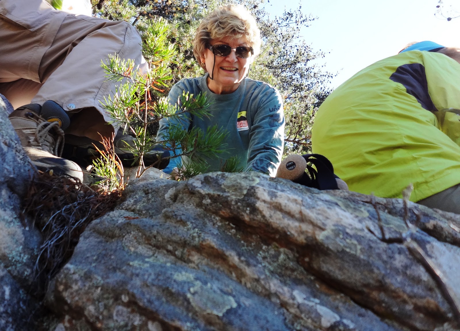
In an effort to get 'er done...Linda 'Putt-Putt' and I (Reggie) 'TNT Java' headed to Hiawassee to meet our shuttle driver on a chilly and windy Friday, February 24th. We were leaving our car at Woody Gap, and he was shuttling us up FS 42 to the parking area .9 miles below Springer Mtn., the southern tip of the AT. Only problem was- I was supposed to be driving to Blairsville! Yes, I can be a dingbat on occasion. With my foot on the pedal, and Putt-Putt turning green on the curvy Hwy. 180, we finally met our driver, and 45 minutes later we were jumping out of the shuttle van to make a run up Springer. We stashed our packs behind a big rock a tad bit up the trail, and made fast work of the climb to the brow. Grabbing the notebook, we both made an entry and signed in with our trail names. Of course, we took a picture!
We picked up our packs on the way down and found the trail on the other side of the parking area. Trying to make up for our lost time, we pushed on to get to our intended camp spot at Three Forks near FS 58. We made it well before 5:00pm and found a spot to stealth camp behind a thicket of rhododendron along the creek on the south side.

We enjoyed our time in this pretty spot beside the creek, ate, and had an 'interesting time' trying to hang our food bags. In an effort not to embarrass myself, I won't share all the gory details. :-) However, after a very cold night, I awoke to retrieve the bags which were hanging together to find my bag had been chewed in to. :-(  My bag- waterproof and supposedly odorproof - had several holes but the food was okay in the wire mesh Outsak. I always put the Outsak with the food inside another bag, along with my hygiene kit and Primus stove/pot/cup. Putt-Putts' bag was perfectly fine. Go figure??

Putt-Putt and I were both having trouble with freezing appendages- her fingers and my toes. We finally got packed up and took off across the bridge and headed toward Justice Creek, our destination, 9.5 miles away.
Of course, we were in Georgia so we began to climb! We arrived at Hickory Flats and took a moment to note the Dallas Woody Memorial.
We were happy to crest Hawk Mtn after that and then down to Hightower Gap where we met an older fella working hard on trail maintenance. When I noted that I had done this trek last year from the other direction, he felt the need to comment that Sassafrass Mtn. was harder to climb from this side! Yikes...neither of us really need to hear that, but we gamely took off with more ups and downs to get to Horse Gap and then it was Sassafras. When that was accomplished, were were anxious to get to Justus Creek- which meant we had to climb Justice Mtn. and then another small mountain...then we descended to Justus Creek. A long, hard day. We camped on the north side of the creek, not bothering to stealth camp and we were later joined by a man who camped a ways down on the other side.


I filtered water while Putt-Putt found a good tree to hang our food bag before it got too dark. We had another freezing night- she with 2 base layers and me with Smartwool - we survived, but it was cold with a capital C.
With a short day ahead of us we packed up and ascended Gooch Mtn. where we began to encounter lots of folks out walking with their dogs. The first couple were considerate, keeping them well aside on their leashes. However, I rounded a bend and met a white husky sitting atop a rocky outcrop where the trail continued. The dog stared me down and then jumped towards me. His owner was underneath the outcrop setting up camp. I yelled 'call your dog, call your dog back'. The owner called out a casual, 'come back, Willow'. The dog continued towards me while I retreated, again asking the owner to call the dog while she barked at me. Finally, the owner emerged up to say, 'She just wants to say hello'. I responded quickly that 'if she senses my fear, she may bite'. I was not happy. I finally passed and waited for Putt-Putt to get past the dog also. Another dog owner on the trail with no consideration whatsoever for other hikers. It makes me very angry! 

We began to encounter pretty spots with nice views available and stopped to enjoy them since we knew we only a little over 6 miles to go to Woody Gap.
When we finally saw the cars at Woody, Putt-Putt announced she thought she would really enjoy getting to a town when we took off on  the big trip...apparently those cars looked good to her!


So, now we've section-hiked from Springer to Unicoi Gap. We are as ready 'enough' for our intended thru-hike of the Appalachian Trail. We've tested our gear, made adjustments, weighed absolutely everything, chucked a few items, and decided to share a little. For myself, I know there will be times when I will have to live by my motto 'Roll with it'. All in all, we are not fearful of the trail, just a little nervous of what we will encounter at hostels (we both like to check out motels on Trip Advisor...this is not a good thing since we aren't going to be able to be so picky!) However, it's the trip of a lifetime, a huge bucket list item and an adventure two fifty+ women who love the outdoors are thrilled to pursue! I feel blessed to be able to attempt this and want to inspire my daughters and grandchildren to always keep a can-do spirit alive in their hearts.
Stay tuned and become a follower (click on the icon to the side, register, load your picture if you like). We want to know you're there and post questions or comments!

Monday, January 9, 2012

Appalachian Trail Part Two, Neels Gap to Unicoi Gap

January 6, 2012, Putt-Putt (Linda) and I began another leg of our AT adventure. The weather had us guessing all week whether we should take off or not. But, we both inhaled a bunch of courage, and met our prearranged shuttle driver at Unicoi Gap. She drove us to Neels Gap and by 1:15pm we posed for our picture in front of the AT sign at Walasi-yi Trading Post.

Heading up the Gap we encountered a gentle grade climbing Levelland Mountain passing by a few scenic spots and nice camping areas until we reached Wolf Laurel Top. This campsite was just .4 miles from our destination of Baggs Creek where we knew there was water. However, we had already planned on a short hike that evening, and knowing we had enough water to get us through the evening and the next morning, we decided that Wolf Laurel was just too pretty a spot to pass up.We met a fella there enjoying the view when we first walked up. After a quick conversation, he left and we set up camp. This is when I realized I had somehow left my rain jacket out of my pack! Thank goodness, I did have my Marmot rain zip pants and my OR gloves with the shell covers built in.
We enjoyed a beautiful soft evening as the full moon rose and the surrounding valleys and ridges began to glisten with yellow lights dotting the landscape. What could be better? A fire that we built ourselves! Yessirree, we did it and patted ourselves on the backs for it too!

Rain came during the night but we both slept well and rose to enjoy a morning of fresh sweet air. The gorgeous sunrise was a bonus!
After breaking camp, we descended the mountain and pumped our water at Baggs Camp. By the time we ascended Cowrock Mountain we were both sweating. I had a hot spot (my first) on a toe so I stopped to treat it with moleskin. We headed out again but by the time we reached the huge rock face with a gorgeous view, we both decided to change our of a layer of clothes. *Note to self: Don't change clothes right on the trail...you're liable to flash fellow hikers, which we came within a hairsbreath of doing! We descended Tesnatee Gap and crossed the road to head up Wildcat Mountain (a tough climb) where we met a young couple who had made a wrong turn from Hogpen Gap. They meant to go to Low Gap Shelter which was the opposite direction. We all crossed the Gap and started up the small climb and reached Low Gap by 3:15pm. The couple had gotten ahead of us and had already started to make camp at a spot above the shelter. Putt-Putt and I checked out the shelter, but after discussion decided to push on toward Popular Stamp Campsite which would make it 8 miles for that day and our next day a bit shorter.
We arrived at Popular Camp about 4:15pm, set up our tents, and had dinner going in no time. We were still hungry and actually wanted to eat the extra dinner I had in my food bag, but we needed more water. So, I jumped up and went off to pump more water. The creek was a approx. 1/8th of a mile down a slope. Here is when I made a  big mistake and learned a hard lesson. I had taken it for granted that the threatening skies weren't going to pour down...they did. Putt-Putt had joined me at the creek so I handed off the pump and took off at a jog toward the tent because I had on my down jacket. As I neared the camp I spied my backpack, and lots of gear lying about and started grabbing and throwing it under my vestibule area. Then I saw the other mistake I had made. I had left with the vestibule unzipped. My sleeping bag was a wet enough I was concerned about being able to keep warm that night. I shoved it all in and zipped up in the vestibule.
It was dark when Putt-Putt came back from the creek, but she had on her rain jacket and worked to clean up our cooking gear and handed me other stuff she found of mine. Yes, I was embarrassed. I waited inside the tent waiting for the rain to subside, hoping I could get outside and hang our food bag before sleep without getting soaked. It was after 8:00pm when I hung the bag. Putt-Putt sat inside her tarp tent and watched the mice coming and going before she slept. :-(

It rained all night and Sunday morning I waited inside my tent, packing up my gear as much as I could tent till about 8:00am when the rain stopped long enough for us to have breakfast and break camp. Putt-Putt had awoken to discover her tarp tent did not keep her dry...her sleeping bag had gotten wet. Much to my surprise during the time I had packed my water reservoir back inside my pack and gotten out to eat breakfast and pump water, mice had managed to chew my nozzle off my hose! That makes the second nozzle I've lost to critters. :-(

Without a rain jacket, Putt-Putt and I managed to arrange my rain fly around my pack and over my head and shoulders. I gave her my pack cover (she had left home without), she managed with stuff sacks as outer gloves over her fleece ones, and so we were off. The rain came steady but not hard, sometimes just drizzling, but we managed with our improvised gear. After lunching at Chattahoochee Gap we were joined by Winter Walker, Mister, and Porcupine on our way to Blue Mtn. Shelter which is about 2 miles away and a climb. Let me just say, this was a loonngg 2 miles; rocky, uneven terrain made worse by the slick rocks and boulders on the trail. But it was also very picturesque with mossy boulder fields along the forest floor, slick with rain and mist. Before the final push up to the shelter, our three companions stopped for a break while Putt-Putt and I pushed forward. Arriving at the shelter, we stopped for a well-deserved break and then started toward Unicoi about 3 more miles away. Of course, there were a few other climbs which I grumbled about, but as we started the rocky descent toward the gap my pace quickened. I was very happy to get to Ruby and find her unharmed. Hopping in the back seat, I changed clothes quickly as Putt-Putt arrived. We ate a good dinner in Hiwassee and drove home on a dark, rainy night.
I've now been christened Java as a trail name. Putt-Putt knows how serious I take my coffee habit in the morning and she says I talk fast and think fast so there you go. I'll accept it. As you see, I've given her the trail name of Putt-Putt because she putters about getting herself together in a very careful manner. We seem to make it work! 
Happily, the Georgia border is getting closer..25.5 miles away. We're hoping some of our hiking club buddies will want to do a day hike to whittle away at that mileage and then we will do the rest in another 2 niter. Happy Trails!

Tuesday, December 6, 2011

The Journey Begins: Woody Gap to Neels Gap

Plans mean nothing until you put them in action. That is exactly what Linda O. and I did last weekend, along with Bill K. (of course!). Many of you know that Linda and I plan on section hiking most of Georgia and then starting off in March to do as much of the Appalachian Trail as possible. We will go back to do Springer to Woody before then. When Bill found out we were going, he jumped at the chance to come. We left Friday morning and found ourselves in Blairsville eating an early lunch before leaving Ruby at Byron Reece Parking lot where we met our shuttle driver. He drove us to Woody Gap about 20 minutes away where Linda and I had to have our picture taken!
We were on the trail shortly after noon with a bright blue sky overhead. The trail began with a slight elevation gain, crossing wooded area's interspersed with rocky sections. Big Cedar Mtn provided our first view with a nice overlook. The trail undulated for the next 5+ miles until we reached Jarrard Gap where the climb required a little more determination. We spotted a couple of other backpackers ahead, and by the time we reached the turn off to Woods Hole Shelter, we had already decided to tent camp at a campsite near the trail instead of using the shelter. It was getting near dusk by the time  tents were set up and we had walked down a trail to get our water. It was darn cold by the time we finished eating. The stars twinkled bright against the night sky and as much as we were enjoying the company, the temperature encouraged each of us to retreat to our tents where we spent the night listening to the wind howl up the side of the mountain.
The next morning we pretended we weren't freezing while we ate breakfast and drank hot drinks. I had a near tragedy when the wind knocked my mug over (it contained my coffee mix). Explaining that it would be a tragedy for Linda and Bill as they would have to deal with grumpy ole' me all day without my caffeine fix, Bill quickly reached for the leaves where the mix spilled and gently coaxed it back in my mug! He's a keeper. By the time we shoved off the wind had calmed down a bit and the blue sky was back overhead. The white blaze led us up toward Slaughter Creek Campground which we explored a bit before continuing on up Blood Mountain where we spotted snow on the trail. A short distance away, we found Blood Mtn. Shelter with remodeling in progress.

Linda and I followed Bill to scramble up big boulders off to the left and above the shelter to a huge rock face where we stopped for a snack and pictures.


Since we had covered 6.5 miles the day before we only had approx. 4 miles to go so we took time to enjoy the vista's along the massive rock faces on top of the mountain. As far as we could see, gentle ridges folded together framed by a vivid blue sky. 

Our descent brought us back to the 'real' world as we greeted day hikers along the trail. Finally, reaching the road and Neels Gap we entered Walasi-Yi to do a little shopping. (Okay, we did a little shopping while Bill waited patiently.) He and I walked down to retrieve Ruby just down the road. After an enjoyable meal at Rib Country, we headed home with Linda and I a little giddy with accomplishing the first leg of our journey.

Wednesday, November 2, 2011

Bear Creek Gets Explored

The crisp fall morning with a blue sky overhead brought out 30 folks excited to try out this new trail that will eventually provide a link between Cloudland and the other  Lookout Mountain trails. Randy Whorton started us off the near the disc golf course. The initial trail was a gentle walk in the woods that brought us by a camp spot with a potty! (Fancy smanchy from what I've had on the trail!) Nearby we passed another relic left to rust in the woods.
We then began to descend gradually around a ridge and then more sharply into a gorge with a huge stacked rock formation along Bear Creek. Here it was necessary to bend down a bit, scooch along underneath the ceiling of rock to get to the spot where we could then rock hop across the creek.


Okay, we descended into the gorge, crossed the creek, so we knew what was coming: climbing up out of it! So, we did. Huffed, puffed, maybe cussed a bit and made it up, and then began another nice walk sloughing through a noisy carpet of colorful leaves. Eventually, we found Randy (who seemed to be everywhere at once) at a trail junction directing us to the right.
We took off again on a gentle up and down and found a spot on a bluff where we settled down for lunch. Debbie, Richard, Linda, Jennie, and the Chronicler hopped down to a lower boulder that jutted out for lunch. Others found spots on top and enjoyed the sun. We were looking across Sitton Gulch at a gorgeous view!  
Debbie is happy with her spot on the bluff.
Donald, Trish, and Pat talked as much as they ate!

Che reading before delivering chocolate!

Val peeking down to the lower rock

Leaving the bluff, we followed the ridge line and then took off through the woods again for another stroll amongst the trees. 
We went up, we went down, we again found Randy pointing us in the right direction. Closing the loop, we descended into the gorge, found the rocky overhang at Bear Creek, ascended, and walked the ridge we first came in on.

There was the fast moving Randy, pointing us in the direction of around the small lake by the disc golf course.

Suddenly the cars were there, and the 9.2 miles seemed very easy. If you're interested in viewing all the pictures taken today, go to my photobucket account: reggiej46 and view the album, Bear Creek 2011

Monday, October 10, 2011

South San Juan Wilderness Kept A Piece of My Heart

Too much of life is spent dreaming about instead of getting about doing. Be open to serendipity and you might find yourself in a position of getting about that doing. I found myself on the receiving end of an offer I couldn't refuse, and so I found myself in Pagosa Springs, Colorado, with Stacy Boone, owner/operator of Step Outdoors, LLC, going through an afternoon of checking gear before we set off on a 4 day/3 night backpacking trip in the nearby South San Juan Wilderness! My friend, Linda, and I, along with Ann from Pennsylvania (minus her daughter who missed the trip due to an ankle injury) checked and re-checked, and weighed our packs, before going back to Be Our Guest Bed & Breakfast. I slept as snug as an ear of corn in cornsilk, but anxious to get the trip started, and so I was up with my backpack, ready when Stacy picked our group up early the next morning.

The soft morning air became clearer and sharper as Stacy's truck lurched along the forest service road to our trailhead, and by the time she parked, the big sky seemed to offer a welcome as it turned to a deep hue of blue. Out of the truck we all bounded, listening to last minute instructions from Stacy, and then loading packs on our back and pausing for pictures by the trail sign.
We followed the Little Blanco trail as the switchbacks lead us through spurts of aspens, spruce and growths of thick golden bushes, winding ever higher and higher. We stopped to gaze in awe at the distant mountain ranges on both sides of the trail as we climbed toward the pass by Nipple Mountain. Stacy kept reminding us to drink water, pay attention to our breathing as we adjusted to the altitude. Linda and I started out with headaches, but the scenery won over our worries.


We paused for a rest at a rocky outcropping 20 minutes from the pass. At the gap, (11,600 feet) I passed through and turned to look back where we had been...it was a gorgeous sight. Clouds dotted the perfect blue sky with spruces reaching up to the heavens, and peaks in the distance teasingly out of reach. Then, I turned back to see where I was now headed and stopped cold where I stood. Emotions welled as I saw endless peaks, more blue sky with even more perfect white clouds, a beautiful valley dipping into never land, and me, standing like a speck witnessing the grandeur. What else could I do? Yes, I cried.

Soon after, we began to gradually descend and bear to the left, encountering more and more huge boulders strewn like marbles on the terrain. Stacy gathered us to discuss the options for the hike, and it was decided to hike the mile down to Quartz Lake, camp, then hike the mile back up the next morning to continue on the Little Blanco Trail over toward the Continental Divide Trail where we had the option of hiking the Summit at 13,300 feet. The camp at Quartz Lake was perfect...a pristine high meadow lake surrounded by beautiful trees with a small clearing.
Stacy proved to be the ultimate guide; making sure we were on task, but allowing us the freedom to make our own mistakes, knowing she was there to point out what we could do better. We learned the importance of working as a team; tents set up, water pumped, and gear in order all while she showed a servants heart by cooking our meals!
That night was cold as a well-diggers behind. I shivered in my tent, zipped inside my 25 deg. down sleeping bag, bundled in my so-called thermal wear, wool socks, wool gloves, wool hat, and Nano Puff jacket! Plus, some insect/critter extraordinaire managed to keep me awake by scratching at the hood of my bag covering my face...oh, how I wished for super critter/insect killing powers that night. The altitude change worked on my body and I was up several times to use the restroom. There are always blessings if you look! If I hadn't had to get up, I might have missed the profusion of the brightest stars I have ever seen flung across the blackest night I have ever seen...with the gauze of the milkyway strewn down like  a bow on a prize. The morning was hard to greet, but I awoke to the noise of Stacy puttering with the dishes. She then urged me to get my camera. I'm so glad I did. My gift this morning was the sun coming down. 

Joy In The Morning at Quartz Lake
Ann led the way back up the the Little Blanco trail junction with a stop along the way to pump more water at a spring nearby. Then, we followed a ridge where we came to a rim overlooking a deep gorge where we could see across to a narrow path along an escarpment. Stacy pointed out this part of the trail had been built with heavy chains and posts to reinforce the footpath.

It was best not to think about where your foot was about to step, so I took off with the goal in mind to get down and up out of the gorge and into the treeline above on the other side. Linda and I found ourselves on the other side, resting just inside the trees, waiting on Stacy and Ann to join us. Soon, they joined us and we rested, snacked and readied for the next phase: climbing to over 12,000 feet, out of the trees to the junction within near spitting distance of the Continental Divide Trail. If we arrived early enough, Linda and I, along with Stacy would attempt the Summit that afternoon. As the afternoon continued, my strength waned. Whether it was the altitude or no sleep the night before, or both, I found myself struggling, but pushed myself to keep going. All I wanted to do was get to the campsite, set up my tent, blow up my pad, and crawl inside my bag. But, we had at least 2.5 miles of mostly climbing to go. We stopped for lunch at a boulder on which we sat. I tried to hide my tiredness, eating my lunch and watching the horizon with the still gorgeous views at every turn. Then, I spotted it: a dark cloud loomed up behind us. Stacy spotted it too and we all surmised, we might be in for a bit of bad weather. When the sleet spattered on the rock, I dug out my poncho, and asked Stacy if it was alright if I started out. Again, I just wanted to get to the destination. Getting the okay, my boots hit the barely discernible trail that began shortly ahead, while the others put on their coats and followed behind. The trail was suddenly gone so I searched until Stacy caught up and we inched behind her while the weather spit and sputtered. The ground was now grassy sod. Not firm like I knew from a Tennessee field, but wobbly blobs of grass seemingly shot through with holes meant to break my ankles. It was like walking 2 miles on a balancing disc (with a 34 lbs. backpack!). When Stacy finally pointed out the trail marker for the junction with the C.D. trail, I struggled towards it.
 Sadly, it was not the actual camp spot- that would be somewhere near- we had to find a place out of the wind in case the weather got worse. Another .5 miles and we found it on the other side of a sloping ridge with water fairly close. In no time, my tent was up, and I was in it..sound asleep, but not before I went to the bathroom twice more...it had to be the altitude wrecking havoc on my kidneys.

I did get up for supper (of course!). The weather held off, but we decided it was too late to make a try for the Summit which we would hold off til in the morning. I slept better, but still not great as a little weasel tried to join me that night. I kept hitting the side of my tent where he was trying to make an opening until he went away. Early the next morning, as agreed, Stacy was up and waking Linda and I up for our Summit. Ann had decided to rest it out. We were treated to a gorgeous sunrise and a herd of elk that came over the top of the ridge and stared at us with indignation that we had dared to camp in their grazing spot. My picture of the elk herd just doesn't do justice...too far away. Needless to say, it was awesome!

Stacy got Linda and I headed toward our Summit. Our goal was to get there and back as close to noon as possible, then we would finish getting packed up and head down below the trees again for our third, and last, night. We passed the junction sign and took off across the slope through a wide gap, heading around behind the ridge from where we  had camped. Then, we were on a wide open grassy range, gazing up at a ridge that hid a secret we wanted to see. As we climbed, the grass gave way in large swaths to drab gray rocks that held defiant bouquets.
Climbing above 12,000 feet now, my breath became shallower, my lungs sought more air as my steps slowed to a crawl. I kept my eyes more on my feet, willing them onward, only occasionally raising them to find Stacy..she was my goal. Get to her..step, get, step, to, step, Stacy. On and on.

Then, Stacy sat near the edge of the grassy rim and my steps seemed to quicken. On, and on, I trudged until my lungs seemed to ready to burst, but I realized I was there- I could see over that sought after Summit!


The Greatest Guide Ever!
Stacy allowed us time to revel in our happiness (and in my case, tears again) before she pushed us downward, back to camp  to meet our time deadline. A piece of me remained behind on 'Our Summit' (nearly 13,000 feet). We didn't have time to go for the actual Summit, so we called this Our Summit. We got back to camp with our faces glowing (and Linda minus her really cute fingerless gloves she left on the Summit) and after lunch were on our way down the mountain.

The terrain noticeably different as we reentered a forest after a 1.5 miles.
Momma bear with cubs across the gorge
Proving that Stacy is the greatest guide ever...she spotted this momma bear and her cubs..thankfully..across the gorge from where we stood. After manuerving a 'gnarly' descent (Stacy's words), we crossed Quartz Creek and made fast tracks for the camp that Stacy had planned all along. (At first, she thought we'd have to find a closer spot since our Summit and descent back to lower elevations took longer than expected.) We exited the San Juan Wilderness area and entered the San Juan National Forest and found ourselves in a delightful meadow by Quartz Creek with beautiful aspens glowing in the afternoon sun.
Stacy treated us to a sweet little fire, wine with our dinner, and s'mores! What more could you want, but your tent? Absolutely nothing, so I retired there to a wonderful nights sleep.

Morning was cold, and I awoke to a bout of pollen infection around my eyes which were puffed out like a blowfish, but I was happy and satisfied. We all enjoyed our breakfast and then packed up for a short 2 mile hike out to Stacy's pre-arranged truck.
Did I mention that Stacy is the greatest guide ever! She never missed an opportunity to teach, encourage, and exhort. Particularly enlightening were the methods she taught me for Leave No Trace which I will take with me to every woods I go. And teach my grandchildren.

This was the trip of a lifetime..a bucket list item black-lined, but one that will never be forgotten. After all, a piece of my heart is back there on 'Our Summit'.
For more pictures, and further adventures Linda and I had in Colorado, including the Million-Dollar Highway trip to Ouray and on to Black Canyon at Gunnison National Park, and then to Mesa Verde National Park, check out my link to http://www.photobucket/.